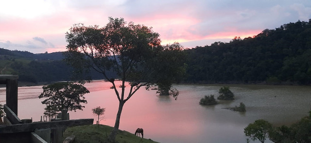
The drought was the worst recorded in the state since 1957. In the article, the researcher recalls that the situation worsened in the autumn and spring months. “This was one of the climatic events of the year that most mobilized Epagri / Ciram teams in the demand for media interviews, government meetings and lectures“, points out the meteorologist.
The lack of rain brought with it an unprecedented environmental event in Santa Catarina, the “ black rain ”, seen in the West, Midwest and Planalto Norte, regions in general most influenced by the “flying rivers”. “Winds at an altitude of approximately 1500m, known as ‘flying rivers’, unable to fulfill their role as moisture carriers from the north to the south of the country, carried out the smoke transport from the fires in the Pantanal (…) The State received the smoke from the Pantanal especially in September”, describes the article.
Thunderstorms
Parallel to the lack of rain, storms hit the state, bringing fear, death and damage to Santa Catarina. On June 30, what happened to meteorologists from Epagri / Ciram considered the event that in the shortest time that had the largest range of severe storms ever recorded in Santa Catarina. That day, a line of instability was organized in the West, moving in about three hours with winds of over 100km / h in most regions of the State.
Despite being known in the media as a cyclone bomb, the winds caused by the cyclone, which moved in the ocean, affected only the Santa Catarina coast and the southern coast the next day. “Even though it was not directly responsible for the severe storms of June 30, the cyclone caused a record wind in Siderópolis, of 168 km / h, on July 1, the largest record of the historical wind series in Santa Catarina”, describes Maria Laura in the article.
Not long after, on August 14 and 15, another severe storm hit the state. This time, the West and North were the most affected areas, registering the formation of two tornadoes, in the municipalities of Tangará and Irineópolis.
Other storms hit the state throughout the year, with wind speeds between 70 and 90km / h. Many of them, accompanied by hail and, although with less impact, causing damage in urban and rural areas, especially between August and October, when the phenomenon occurred more frequently in the various regions of Santa Catarina. “If spring is normally the time of year with the highest incidence of storms and hail in SC, probably the drier weather in 2020 has contributed to this spring the incidence of the phenomenon was even greater during the passage of cold fronts“, analyzes the weatherman.
Temperature
Regarding the temperatures, the contrast between the heat of the Itajaí Valley in summer, with a maximum of 40ºC in February, and the cold of the Serra in winter, with a minimum of -8.1ºC in Urupema, on July 15, and not surprisingly, and -8.6ºC in Bom Jardim da Serra, on August 21st.
However, spring again surprised. “We barely said goodbye to winter and the temperature reached 43.8ºC in Jaraguá do Sul, on October 2nd, being the second highest record in the history of SC”, details Maria Laura. In the following weeks, the cold air masses returned to the South of Brazil and on November 5, the minimum in the State were between 6 and 10ºC in most regions. In the Serra there was a negative temperature and frost.
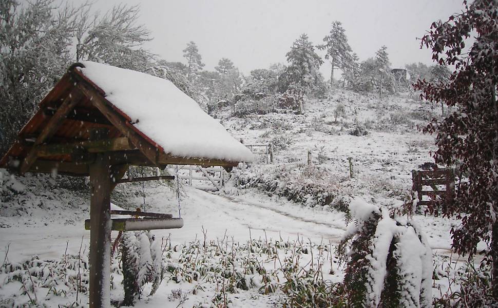
The snow came in the Santa Catarina winter, as expected, but the geographic distribution surprised the meteorologists. Between August 20th and 21st she arrived, maintaining the climatology of at least one event in the year. But it was not concentrated in the high areas of the South Plateau, as it usually happens. Snow was recorded in the South and North Plateaus, but the conditions for the phenomenon were more favorable in Greater Florianópolis Serrana. Rancho Queimado was one of the municipalities that had snow in a longer period, reaching the ground.
Tide
High tide was also present last year. Two episodes, between April 3 and 9, are among the four with the highest sea level recorded on the coast of Santa Catarina since 2012, the year of creation of the tide network monitored by Epagri / Ciram. In those days, measurements made in Passo de Torres, Imbituba, Laguna, Florianópolis and Barra Velha identified floods at high tide along the coast, causing disturbance on beaches and traffic.
The article reports that April and May were the months of the year with the highest number of cases with a hangover and high tide in Santa Catarina, due to the greater persistence of the south wind associated with the frequent cyclones that acted close to the coast. With this weather condition, the mullet harvest started well in May, but worsened in the following months, due to the low persistence of the south wind during winter, which is not common on the coast of SC.
Flash flood
The period analyzed in the scientific article ends in October, but in December another meteorological event affected the State in an extreme way, taking lives and leaving material losses. Between the night of December 16 and the morning of the 17th, Presidente Getúlio, Ibirama and Rio do Sul, in the Upper Vale of Santa Catarina, registered a high level of rain in a short period.
The municipality of Presidente Getúlio was the hardest hit, where a flood swept through several neighborhoods, leaving the dead and destruction. The accumulated precipitation in 24 hours was between 80 and 100mm, which is equivalent to the expected for about 20 days of rain. The concentration of this volume in a short time worsened the situation.
Researcher Maria Laura’s article shows how 2020 was an atypical year in terms of weather. If the pandemic caused by Covid-19 was not enough, the climate also decided to test the limits of Santa Catarina last year.
Click here to download the PDF with the full scientific article.